|
Re: Packard Plant: Aerial Photos - Dec 2011
|
||||
|---|---|---|---|---|
|
Forum Ambassador
|
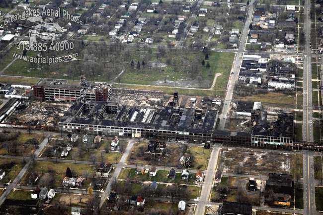
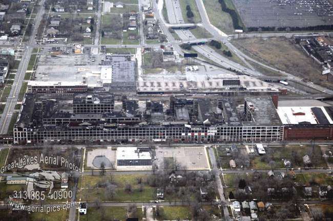
What a place. What was the total length--something like a half mile to mile?? Photos are different angles so perspective is a bit off but I did a halfway decent merge if it would be appropriate to post. Is the building with white roof on extreme right near freeway part of plant?
Posted on: 2011/12/3 17:43
|
|||
|
Howard
|
||||
|
||||
|
Re: Packard Plant: Aerial Photos - Dec 2011
|
||||
|---|---|---|---|---|
|
Home away from home
|
Yes, the total distance from Frederick St. on the south (somewhat outside of the photo) to the I-94 (Ford) expressway is 0.67 miles, with East Grand Blvd about at the half-way point.
The buiding with the white roof is Merlin Aircraft Assy. building. A street photo is attached. It was taken at the corner of Concord and what is now the service drive for the Ford expressway, looking to the southwest. All of this is explained in issue #137 of The Packard Cormorant - Winter 2009 edition. This issue was devoted to the PMCC Detroit factory and is a wealth of information. If you want a copy, then write to me. The Packard Motor Car Foundation has all the extra copies and they are for sale at the Packard Proving Grounds. I can make arrangements to get one shipped to you - cost: $15. Attach file:  (72.16 KB) (72.16 KB)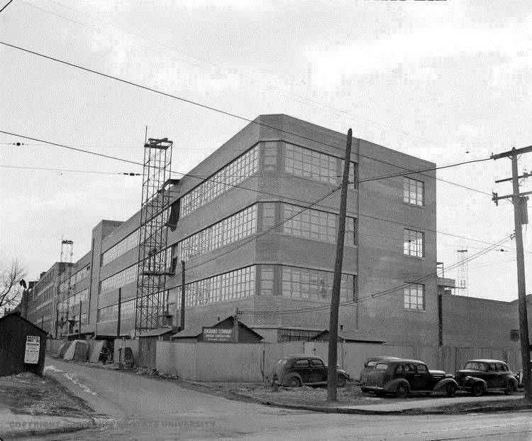
Posted on: 2011/12/3 19:29
|
|||
|
||||
|
Re: Packard Plant: Aerial Photos - Dec 2011
|
||||
|---|---|---|---|---|
|
Forum Ambassador
|
The buiding with the white roof is Merlin Aircraft Assy. building.
Thanks. It looks to be in pretty decent condition compared to the rest. The buildings behind the plant next to freeway also look relatively decent as do a few other structures surrounding the plant devastation albeit amidst many other burned out buildings. There must be a little activity still -- although maybe not the kind a cautious person would be traveling there to transact.
Posted on: 2011/12/4 13:31
|
|||
|
Howard
|
||||
|
||||
|
Re: Packard Plant: Aerial Photos - Dec 2011
|
||||
|---|---|---|---|---|
|
Home away from home
|
Quote:
Right HH...a true representation of America at its present "worst" and its past "best"...what a sad picture of prosperity gone wrong...
Posted on: 2011/12/5 10:46
|
|||
|
||||
|
Re: Packard Plant: Aerial Photos - Dec 2011
|
||||
|---|---|---|---|---|
|
Home away from home
|
What's really sad is that per square mile, that area of Detroit probably played host to the greatest collection of engineering brilliance ever assembled in one area...it makes you wonder how much more brilliant the minds had to be that caused their demise...or was it simply a case of greed that overcame the need?
Posted on: 2011/12/5 11:00
|
|||
|
||||
|
Re: Packard Plant: Aerial Photos - Dec 2011
|
||||
|---|---|---|---|---|
|
Home away from home
|
Hello HH:
Yes, RELATIVILY speaking it is in better shape, but that is not saying a lot. And the Harper & Stone Building to the west (as you say, behind it) is occupied and open for business. But, all you have to do is go to Google Earth and type in "1580 East Grand Boulevard, Detroit, MI" and get down onto Street Level and then "drive" around the PMCC. I did this and below are a few photos from Google Earth. One is a recent view of the Merlin Building taken in the same location as the one I posted earlier when it was under construction. Another is a relative comparison to show where the PMCC Building connects to the Merlin Assy. Bldg. And the last is the NW corner of East Grand Blvd. and Concord St. --Roger-- Attach file: (62.49 KB)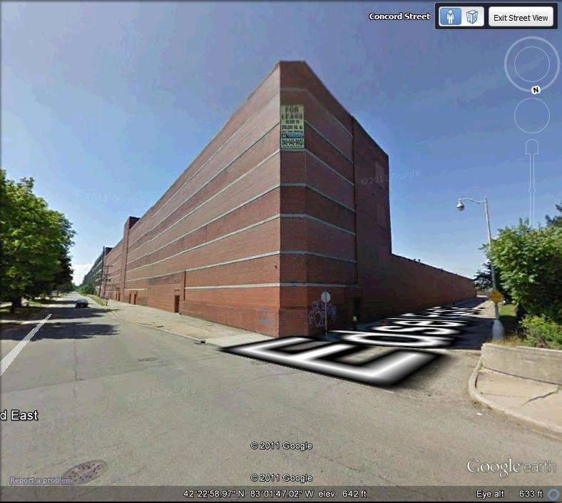 (87.61 KB) (87.61 KB)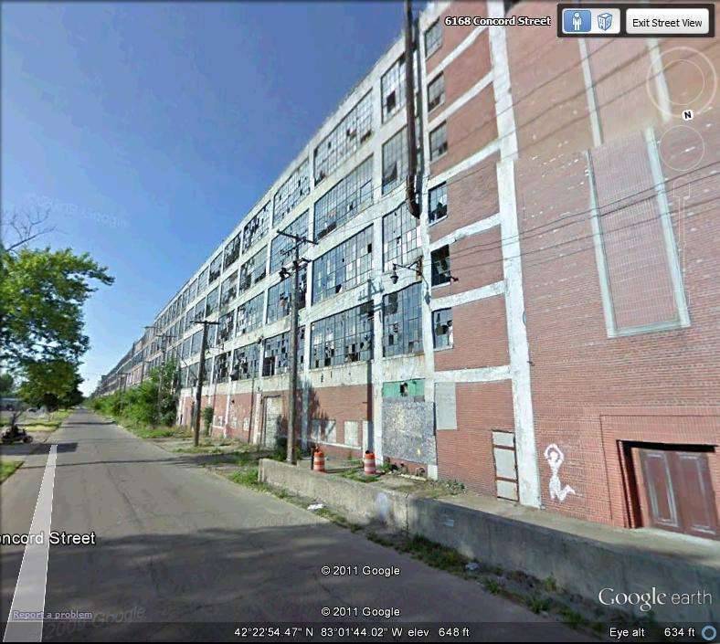 (85.67 KB) (85.67 KB)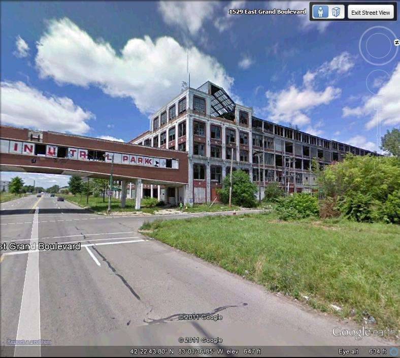
Posted on: 2011/12/5 11:04
|
|||
|
||||
|
Re: Packard Plant: Aerial Photos - Dec 2011
|
||||
|---|---|---|---|---|
|
Home away from home
|
Quote:
Unharnessed GREED will do it every time! That area was also one of the main reasons why before any sporting event we sing the "Star Spangled Banner" instead of "Deutchland, Deutchland Uber Alles"! It's a good thing we don't have to rematch WWII today.
Posted on: 2011/12/5 16:46
|
|||
|
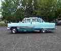
1951 200 Deluxe Touring Sedan
1951 200 Deluxe Touring Sedan (parts ?) 1951 Patrician Touring Sedan 1955 Patrician Touring Sedan |
||||
|
||||
|
Re: Packard Plant: Aerial Photos - Dec 2011
|
||||
|---|---|---|---|---|
|
Home away from home
|
Ya! So much worse for the Nazis this time, they would not stand a chance.
(o[]o)
Posted on: 2011/12/5 22:56
|
|||
|
We move toward
And make happen What occupies our mind... (W. Scherer) |
||||
|
||||
|
Re: Packard Plant: Aerial Photos - Dec 2011
|
||||
|---|---|---|---|---|
|
Home away from home
|
One must remember-or at least take into account-that there was a lot more of the Packard plant once in years before the Edsel Ford Expressway was dug in and the northern end of the facility (and Harper Avenue) was whacked off. At one time there was a test track and other facilities/buildings NORTH of Harper (where the Ford Expressway is now). The entire Packard Plant originally was more than a mile long.
The building (with the white roof) on the Harper end of Concord was originally built in conjunction with the Packard Merlin Engine, but also served other functions under Packard. After Packard left, this building was occupied by Essex Wire Corporation and had some offices in it. Essex Wire also had another former Packard building located on the Mt. Elliott side of the Packard railroad tracks and along side of the Ford Expressway. Also, much of the reason why the plant became so isolated (aside from city battles over taxes, greed and other reasons) was that very freeway. Grand Blvd WAS the main traffic artery in Detroit in that area until Edsel Ford Freeway was completed. After that, it was like the same thing that happened to Route 66 after the big new federal interstates were built. The steady stream of cars on Grand Blvd. past the plant was slowed to a trickle after the expressway was built. The overgrown green area to the right of the photo showing the Packard Bridge used to be the main employee's parking lot. It was once packed with cars on any weekday. some of them even Packards!
Posted on: 2011/12/5 23:53
|
|||
|
||||


